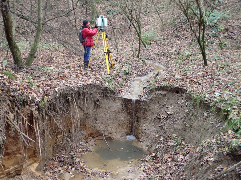
Monitoring of the development of the gully in Kol. Celejów on the Nałęczów Plateau, coordinated by dr hab. Jan Rodzik, Prof. UMCS (Department of Hydrology and Climatology) includes:
- recording the intensity and size of precipitation with the A-STER pluviograph;
- registration of water outflow and suspension based on Thalimedes OTT water level meter, Thomson triangular overflow and analysis of water samples taken during the runoff;
- registration of changes in the largest active cut based on TLS laser scanning performed twice a year.
Selected publications:
- Furtak T., Rodzik J., 2007; Charakterystyka odpływu ze zlewni wąwozowej na Wyżynie Lubelskiej. [w:] red. Z. Michalczyk, Obieg wody w środowisku naturalnym i przekształconym, Badania hydrograficzne w poznawaniu środowiska, 8, Wyd. UMCS, 219-226.
- Kociuba W., Janicki G., Rodzik J., 2014; 3D laser scanning as a new tool of assessment of erosion rates in forested loess gullies (case study: Kolonia Celejów, Lublin Upland). Annales UMCS, B, 69 (1); 107-116.
- Kociuba W., Janicki G., Rodzik J., Stępniewski K., 2015; Comparison of volumetric and remote sensing methods (TLS) for assessing the development of a permanent forested loess gully. Nat. Hazards, 79, 139-158.
- Rodzik J., 2008; Wpływ deszczów ulewnych i roztopów na rozwój wąwozu lessowego. Landform Analysis, 8, 56-59.
- Rodzik J., Furtak T., Zgłobicki W., 2009; The impact of snowmelt and heavy rainfall runoff on erosion rates in a gully system, Lublin Upland, Poland. Earth Surf. Proces. Landforms, 34, 1938-1950.