Due to the settings of your browser and in order to facilitate the functioning of the umcs.pl webpage, the cookies have been installed. By continuing to use this webpage, you accept their usage. You can change this in the settings of you browser.
I suggest to e-mail me one day before a planned meeting
Courses:
Winter semester:
- Mathematical bases of maps (1gi1)
- Spatial systems and analyses in tourism resource management (3tir1),
- Methodology of geographical sciences (1geo2),
- Official cartography (1geo2),
- Spatial data processing techniques (1geo2).
Summer semester
- Geographic information systems (1gw1),
- Engineering seminar(3gi1),
- Mathematical basis of geoinformation (1geo2),
- Advanced research methods in geography and spatial management (2geo3).
Personal information
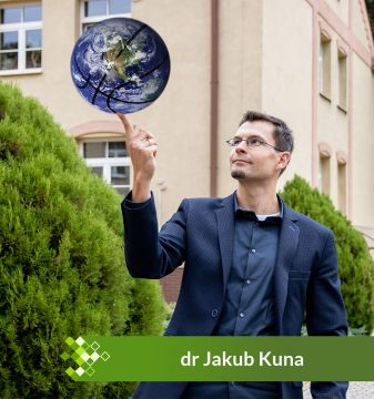
Geographer, cartographer, GIS-man.
Assistant professor at the Department of Geomatics and Cartography. PhD in Earth Sciences (geography) in 2017. UMCS graduate, researcher-lecturer since 2015.
Research interests: cartographic visualization, computer graphics, geostatistics with R programming environment, modern methods of analysis and GIS tools in the study of the past (Historical GIS), early topographic maps, the history of Lubelskie region.
Privately: husband & father, sports enthusiast.
Watch my lectures online (Polish):
Scientific Activity
Functions:
2024 - Polish Geographical Society Cartographic Branch Executive Board Member - deputy chairman - more info 2023 - Secretary of the 45th Polish National Cartographic Conference - more info 2021 - member of the National Committee for the International Cartographic Association 2020 - Secretary of the 12th Polish National Competition of Diploma Theses in the field of cartography, geomatics and geoinformation - more info 2018 - Secretary of the international conference 1st Cartographic Open Plenary Meeting - Lublin 2018: Content, form and function of thematic maps in the era of Geographical Information Sytems - more info
Grants:
2023-2027 - "Historical Atlas of Polish Towns [part of european HTA series]: Kazimierz Dolny, Puławy, Wąwolnica", grant NPRH no NPRH/DN /SP/508655/2021/11 - research task manager, researcher 2021-2024 - "Digital Research Infrastructure for the Arts and Humanities DARIAH-PL", EU Funds, POIR.04.02.00-00-D006/20, by UMCS in Lublin - scientific coordinator, institute coordinator, researcher 2020-2021 - "Development of the Ortophotomap of Lublin 1939–1945", NCN, Miniatura 4.0, nr 2020/04/X/HS4/00382, by UMSC in Lublin - grant manager - go to the project page
2020-2021 - "Historical Atlas of Polish Towns [part of european HTA series] T. 1. Prusy Królewskie i Warmia, t. 3 Mazury, t. 4 Śląsk, T. 5 Małopolska", grant NPRH no 11H 16020984, by Towarzystwo Naukowe w Toruniu - researcher, GIS specialist, more at http://atlasmiast.umk.pl/ 2019 - "Spatial Development of Lublin", grant MKiDN no 03745/19/FPK/DWIM, by "Grodzka Gate - NN Theatre" Centre - researcher, GIS specialist, cartographic editor, more at http://teatrnn.pl/rozwoj-przestrzenny 2017-2021 - "Innovative system of safety and logistics management in the transportation of goods with the use of geoinformation technologies", NCBiR, POIR.01.01.01-00-0371/17, by FINDEWAL sp. z o.o. - specialist in geoinformation technologies, more info 2014-2016 - "Shtetl Routes. Vestiges of Jewish cultural heritage in cross-border tourism", UE, ENPI, ENPI PBU/0594/11, by "Grodzka Gate - NN Theatre" Centre - GIS specialist, cartographic editor, more info
Publications:
Theses: 2017 PhD: Cartographic reconstruction of the historical urban structure on the example of Bychawa in 1938 - under the supervision of dr hab. Andrzej Czerny, prof. UMCS, Department of Cartography and Geomatics, UMCS Lublin - read PDF 2012 master: The problem of contemporization of the form of presentation of bygone maps - under the supervision of dr hab. Jerzy Mościbroda, prof. UMCS, Department of Cartography and Geomatics, UMCS Lublin. 2010 bachelor: The analysis of the spatial development of Bychawa on the basis of cartographic materials - under the supervision of dr Paweł Cebrykow, Department of Cartography, UMCS Lublin.
Books: - Kokowski A. Kraszczuk R., Kuna J., Łoś J., Myzgin K., Pietruczuk J., Rola J., Szałkowska-Łoś J., Zawadzki M., 2023: Corpus der römischen Funde im europäischen Barbaricum. Polen. Bd. 6. Krajna (mit Randgebiet - von der Brda bis zur Weichsel), PAU, ISBN: 978-83-76763-68-2 - Gładysz-Juścińska M., Kokowski A., Niezabitowska-Wiśniewska B. (red.), 2021: Corpus der römischen Funde im europäischen Barbaricum. Polen. Bd. 4. Lubliner Land, PAU, ISBN: 978-83-66210-21-9 - info (www) - Kuna J., 2018: Bychawa 1919–1939. Kartograficzna rekonstrukcja miasta (Bychawa 1919–1939. Cartographic reconstruction of the town), Maria Curie-Skłodowska University Press, Lublin, 240 pp. ISBN 978-83-227-9075-5 - read PDF - Czerny A., Doroszewicz W., Kuna J. (eds.), 2018: 1st Cartographic Open Plenary Meeting - Lublin 2018: book of abstracts, UMCS, Lublin. pp. 56 - read PDF
Articles:
Kuna J., 2022: The Orthophotomap of Lublin 1944: from Luftwaffe photographs to map application – idea, methods, contemporary challenges of processing and publishing archival aerial photographs, "Polish Cartographical Review", Vol. 54. Nr. 1, pp. 123-142 - doi: 10.2478_pcr-2022-0009.pdf
Kuna J., Jeremicz J., Kociuba D., Niedźwiadek R., Janus K., Chachaj J., 2022: Interactive HGIS platform union of lublin (1569): A geomatic solution for discovering the Jagiellonian heritage of the city, "Journal of Cultural Heritage", Vol. 53, pp. 47-71 - doi:10.1016/j.culher.2021.11.001
Kuna J., Kowalski Ł., 2020: Exploring a non-existent city via historical GIS systems by the example of the Jewish district 'Podzamcze' in Lublin (Poland), "Journal of Cultural Heritage",Vol. 48, pp. 328-334 - doi: 10.1016/j.culher.2020.07.010
Kuna J., 2020: Metoda progresji, retrogresji i kombinowana w kartograficznej rekonstrukcji zabudowy - studium na przykładzie Bychawy w 1938 roku (Methods of progression, retrogression and combined in the cartographic reconstruction of historical settlements - case study Bychawa in 1938) [in:] Konopska B., Ostrowski J., Weszpiński P. (red.), 2020: Mapa w służbie odrodzonej Polski, "Z dziejów kartografii", IHN PAN, t. 23, pp. 205-224.
Kuna J., 2019: Between retrogression and progression – a proposal for a new method to recreate the historical building layout of settlement units, "Polish Cartographical Review", Vol. 51, Issue 4, pp. 215–229 - read PDF
Kuna J., 2018: 'Partially compiled' maps 1:25,000 by Polish Military Geographical Institute (1919–1939), "Polish Cartographical Review", Vol. 50, Issue 1, pp. 31–46 - read PDF ; also available in Polish - read PDF
Kuna J., 2016: Cartographic visualization of Jewish heritage in cross-border tourist project Shtetl Routes (Poland, Belarus, Ukraine), "Polish Cartographical Review", Vol. 48, Issue 4, pp. 173-183 - read PDF
Kuna J., 2015: Metodyczne aspekty analiz przestrzennych GIS wykorzystujących dawne mapy topograficzne (Methodical aspects of GIS spatial analysis using old topographic maps) [in:] Czerny A. (red.), 2015: Dawne mapy topograficzne w badaniach geograficzno-historycznych (Old topographic maps in geographical and historical research), Wydawnictwo UMCS, Lublin, pp. 125-149 - read PDF
Kuna J., 2015: Proste animacje 4D w GIS (Simple 4D animations in GIS), "Acta Universitatis Lodziensis, Folia Geographica Socio-Oeconomica", nr 22/2015, pp. 161-169 - read PDF
Kuna J., Rzucidło A., 2015: Jak zobaczyć informację, czyli różnorodne funkcje mapy w procesie wymiany informacji (How to perceive information - variety of maps' functions in the communication process), "Folia Bibliologica", Vol 57, pp. 87-97 - read PDF
Kuna J., Rzucidło A., 2014: Aleksandra i Daniel Mizielińscy: Mapy. Obrazkowa podróż po lądach, morzach i kulturach świata - review, "Polski Przegląd Kartograficzny", t. 46, nr 3, pp. 319-321.
Kuna J., 2014: Zmiany znaków na XX-wiecznych mapach topograficznych w skali 1:100000 (Symbol changes on 20th century topographic maps in 1:100000), "Polski Przegląd Kartograficzny", t. 46, nr 1, pp. 47-61 - read PDF
Kuna J., 2014: Problem uwspółcześnienia formy prezentacji map dawnych (The problem of contemporization of the form of presentation of old maps) [in:] Konopska B., Ostrowski J. (red.), 2014: Dawne mapy jako źródła w badaniach geograficznych i historycznych (Old maps as a source in geographical and historical research), "Z Dziejów Kartografii", t. 18, pp. 79-92 - read PDF
Interactive maps(online): - Interwar Lublin - go to - Lublin during the Union of Lublin (16th century) - go to - Shtetl Roues. Vestiges of the Jewish Heritage in cross-border tourism - go to
Maps:
Kokowski A., Kuna J., Zawadzki M., 2021. Corpus der römischen Funde im europäischen Barbaricum. Polen 4. Lubliner Land, 1:450 000 [w:] Gładysz-Juścińska M., Kokowski A., Niezabitowska-Wisniewska B., 2021: Corpus der römischen Funde im europäischen Barbaricum. Polen. Band 4. Polska Akademia Umiejętności, Kraków, ISBN 978-83-7676-338-5
Chachaj J., Janus K., Jeremicz J., Kociuba D., Kuna J., Mącik H., Niedźwiadek R., 2019. LUBLIN – rekonstrukcja miasta w okresie Unii Lubelskiej (XVI w.), 1:3 000 [in:] Niedźwiadek R. (red.), 2019. Krakowskie Przedmieście w 450-lecie Unii Lubelskiej , Gmina Lublin, ISBN 978-83-949126-9-7
Kuna J., Kuna A., Majuk E., Tarajko M., 2017: Shtetl Routes: Vestiges of Jewish cultural heritage in cross-border tourism, tourist map 1:900 000, “Grodzka Gate – NN Theatre” Centre, Lublin, ISBN 978-83-65444-08-0.
Kuna J., Kuna A., redakcja kartograficzna, plany miast [w:] Majuk E. i inn. 2015: Szlakiem sztetli. Podróże przez Zapomniany Kontynent, Ośrodek „Brama Grodzka – Teatr NN”, wyd. I, Lublin, ISBN. 978-83-61064-93-0.
Kuna J., Meksuła M.W., Kałamucki K., Bielak A., 2013: 8.1 Rozmieszczenie ludności (8.1 Distribution of population) [in:] Kałamucki K., Grabowski T. (red), 2013: Roztoczański Park Narodowy - przyroda i człowiek - monografia kartograficzna (Roztocze National Park - environment and human being - cartographic monograph), RPN, Zwierzyniec
Kuna J., Meksuła M.W., Kałamucki K., Borek A., 2013: 8.2 Rolnictwo (8.2 Agriculture) [in:] Kałamucki K., Grabowski T. (red), 2013: Roztoczański Park Narodowy - przyroda i człowiek - monografia kartograficzna (Roztocze National Park - environment and human being - cartographic monograph), RPN, Zwierzyniec
Kasiborski P., Kuna J., Łukasik A., Meksuła M.W., Piskorski M., 2012: Szlak Renesansu Lubelskiego - mapa turystyczna 1:150000 (Lublin Renaissance Route - tourist map 1:150000), LROT/Kartpol, Lublin, ISBN 978-83-62664-17-7